
CDL Low-Clearance Guide: Prevent Bridge Strikes
A bridge strike is usually the final link in a chain of preventable decisions: an assumed vehicle height, an unverified shortcut, a missed warning or a driver who continued after the safe exit disappeared. Break that chain early. Know the truck’s true operating height, validate the entire route and treat every doubtful clearance as a stop—not a challenge.
Low-clearance prevention is different from ordinary navigation. A missed turn usually adds time. A wrong height decision can damage the vehicle, close a road, injure people and compromise a bridge or overhead system. The professional habit is to resolve uncertainty while there is still room to stop, turn or reroute safely.
The federal baseline: follow the road’s rules and plan for size
49 CFR 392.2 requires a commercial motor vehicle to be operated in accordance with the laws, ordinances and regulations of the jurisdiction where it is operating, unless an FMCSA rule imposes a higher standard of care. That makes posted restrictions and State or local vehicle-height rules part of the operating decision.
The federal Class A ELDT curriculum specifically requires trip-planning instruction on safe routes, permits, vehicle size and weight limits, restricted-route identification, clearance at railroad-highway crossings, and the advantages and limitations of GPS and trip-routing software. A navigation app is therefore one input—not the authority that clears the truck.
Start with the height of this vehicle today
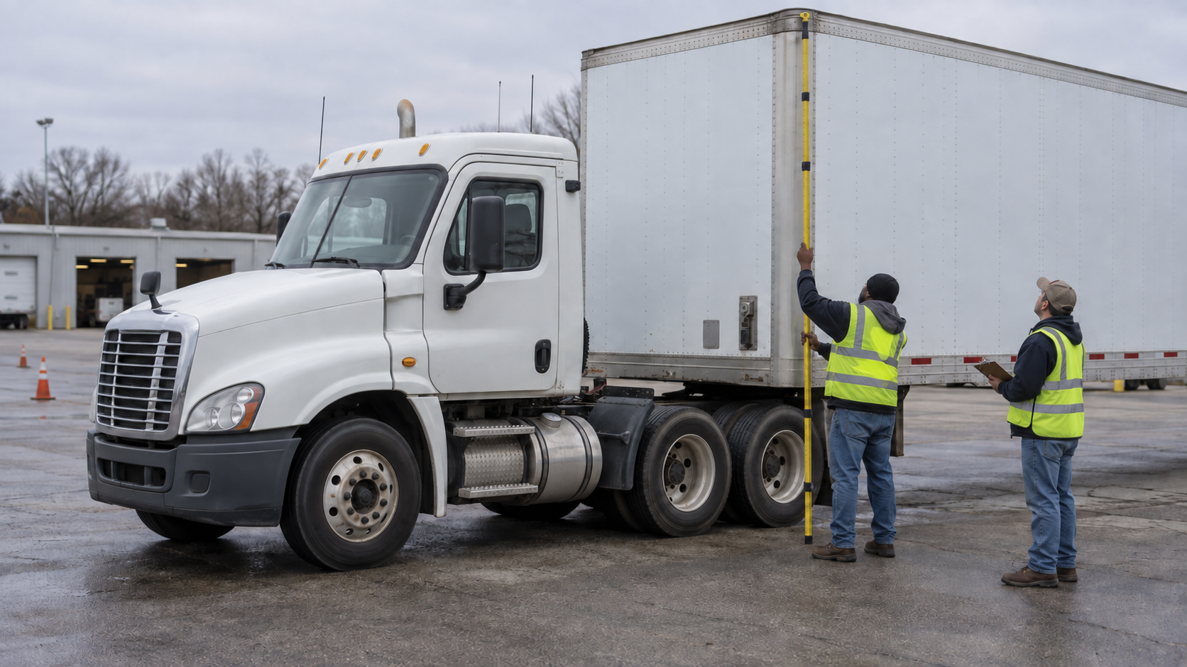
Do not rely on a height remembered from another tractor, trailer or load. Record the highest point of the complete vehicle in its normal operating condition. For a dry van, the trailer roof may be the highest point; on other equipment it might be cargo, a refrigeration unit, vent, stack, boom or accessory.
- Use a level, safe measuring location. Secure the vehicle according to company procedure and keep trainees clear of traffic and moving equipment.
- Identify the true highest point. Inspect the entire combination. Do not assume the front corner represents equipment mounted farther back.
- Use an appropriate height-measuring tool. Keep it vertical and read it from the correct reference surface. Never climb onto tires, tanks, steps or bodywork to improvise a measurement.
- Record the measurement where it is usable. Follow carrier policy for the in-cab height card and commercial-routing vehicle profile.
- Measure again after a meaningful change. A different trailer, top-loaded cargo, modified equipment, suspension work or tire change can invalidate an old figure.
Do not subtract an informal “safety margin” from a sign or round the truck’s height down. A listed clearance is a decision boundary, not a target. When the numbers are close, stop and verify through the road authority or choose a confirmed alternate route.
Build a clearance verification stack
| Information source | What it can establish | What it cannot replace |
|---|---|---|
| Vehicle and load record | Current measured height and configuration | A route check for every road and structure |
| Official truck-route or permit source | Current restrictions, designated routes and permit conditions | Posted signs or temporary field controls |
| Commercial routing tool | A proposed path using the entered vehicle profile | Official restrictions, driver observation and judgment |
| Roadside sign or overheight system | A restriction or warning at the actual location | Enough stopping space if noticed too late |
| Dispatcher or customer directions | Local context and facility access | Independent validation of public-road legality and clearance |
Start with the CDL trip-planning guide and ProntoCDL’s road-navigation map. Confirm the last miles as carefully as the interstate segment. Low structures often appear after a route leaves the major highway for a customer, yard or detour.
Read low-clearance warnings as early decision points
The current FHWA Manual on Uniform Traffic Control Devices identifies the W12-2 family of Low Clearance signs. The standard includes advance warning and structure-mounted treatments, including versions used where height varies across an opening. The useful lesson for a driver is timing: the advance sign is the place to reject the route, not the structure itself.
- Scan well beyond the vehicle ahead so a warning sign is not hidden until the last second.
- Read the displayed height and any lane, shoulder, distance or directional information together.
- Watch for a second sign on the structure and for overheight detection messages or activated beacons.
- Do not change lanes under an arch or cross a centerline to chase a higher-looking opening.
- Treat construction signs and temporary traffic control as current field information. A normal route may have a new restriction.
Road resurfacing, construction platforms, snow or ice accumulation, a sag or crest in the roadway and an arched opening can affect the practical clearance available to a long commercial vehicle. Visual appearance cannot verify inches from the cab.
Use a deliberate approach routine
- Observe early. Search for truck restrictions, advance warning signs, lane-specific arrows and a safe place to leave the route.
- Compare. Compare the posted value with the documented height—without mental rounding or wishful assumptions.
- Slow smoothly. Preserve control and communicate to following traffic. Avoid a panic stop if a controlled stop can be made sooner.
- Decide before commitment. Once curbs, traffic or geometry remove the ability to exit, the recovery becomes harder and more dangerous.
- Stop on doubt. If the sign, measurement, lane or route status is uncertain, do not pass under the structure.
Never let a honking vehicle, delivery deadline or unverified reassurance turn a no-go decision into a trial pass. “It looks close” means the route is not confirmed.
When the route is wrong, protect the recovery
Stop before the structure at the safest location still available. Use hazard warning flashers when appropriate and communicate the exact road, direction, structure and truck position to dispatch. Contact the responsible road or law-enforcement authority when traffic control or a public-road recovery is needed.
Do not back into live traffic, make an illegal U-turn, enter a prohibited street or send an untrained person into traffic to wave vehicles around. A controlled recovery may require law enforcement, an authorized traffic-control team and qualified spotters. Follow their direction and confirm the entire alternate route before moving.
This is also why the driver should not continue past the last legal turn while trying to recheck the map. Stop earlier, in a lawful location, and solve the routing problem with the vehicle secured. Review ProntoCDL’s mobile-phone and distracted-driving guide before using any device.
If contact occurs, treat it as an incident
Stop immediately and assess personal safety. Notify emergency services or the responsible authority as required by the situation, report the incident through carrier procedure and warn other road users without placing yourself in traffic. Do not pull away merely to inspect the damage: movement can worsen damage to the structure, vehicle, cargo or overhead equipment. Wait for direction from responders and qualified assessors.
If the CMV is stopped on the traveled portion or shoulder and 49 CFR 392.22 applies, the driver must activate hazard flashers immediately and place the required warning devices as soon as possible and within 10 minutes, subject to the rule’s exceptions and special placement patterns. Use the CMV emergency-equipment checklist to review those patterns before an emergency.
After authorities release the scene, inspect and document the vehicle through the carrier’s process. The post-trip inspection and DVIR guide explains how a defect report connects the driver with maintenance and the next operator.
A low-clearance training drill
An instructor can turn route planning into a repeatable decision exercise without putting the vehicle near a real low structure:
- Have the trainee locate and measure the highest point of the training combination on a level pad.
- Enter the verified dimensions into a commercial routing profile and record them using carrier procedure.
- Present three sample routes: one confirmed, one with a clear restriction and one with incomplete information.
- Ask the trainee to identify the last safe decision point on each route.
- Rehearse the radio or phone report with location, direction, vehicle height and the observed sign.
- Have the trainee reject the uncertain route and explain how to obtain an official answer.
Connect the exercise to ProntoCDL’s Class A ELDT guide, then reinforce route-planning vocabulary and judgment in the free CDL practice center.
Practical takeaways
- Know the measured height of the current vehicle and load—not a remembered fleet number.
- There is no single federal maximum height that guarantees access everywhere.
- Validate the full route with current official sources; commercial GPS is only a planning aid.
- Use advance low-clearance warnings as decision points and read all lane-specific information.
- Never round down, “try it,” change lanes under an arch or follow an unverified shortcut.
- Stop before commitment when any clearance is uncertain.
- Do not improvise a public-road backout or U-turn; obtain proper traffic control and direction.
- After contact, stop, secure the scene, notify authorities and wait for assessment before moving.
CDL low-clearance FAQ
Is 13 feet 6 inches the universal maximum truck height?
No. Federal law does not set one nationwide maximum vehicle height. State and local limits vary, and particular roads or structures can have lower clearances. Drivers need the actual height of the current vehicle and the rules and restrictions for the route being used.
Can a truck GPS guarantee enough vertical clearance?
No. A commercial routing tool can help plan, but it can contain stale data, use the wrong vehicle profile or route a driver onto a restricted road. Verify the route with current official information and obey every posted sign and traffic-control device.
What should a driver do when a clearance sign is close to the truck height?
Do not guess or inch under the structure. Stop before the point of commitment at the safest available location, activate warning signals as appropriate, and contact dispatch and the responsible road or law-enforcement authority for a verified route or controlled recovery.
Can a driver simply back away from a low bridge?
Backing on a public road can expose traffic, pedestrians and fixed objects to serious risk. Do not back blindly or attempt an improvised U-turn. Follow carrier procedure and obtain appropriate traffic control, official direction and qualified spotting when recovery requires backing.
Why can clearance vary across the same structure?
An arch, road crown, lane profile, resurfacing or signed shoulder condition can make the usable height different across the opening. Read lane-specific and structure-mounted signs, stay in the authorized lane and never assume the highest-looking point is a legal path.
Does federal ELDT cover low-clearance route planning?
Yes. The Class A ELDT curriculum requires trip-planning instruction that includes safe routes, restricted routes, vehicle size and weight limits, permit requirements, safe clearance and the strengths and weaknesses of GPS and routing software.
Measure first. Decide early.
Build the route around the actual truck, keep a verified exit available and stop whenever the clearance cannot be confirmed.
Start free CDL practice