
CDL Trip Planning Guide: Routes, Clearance, Fuel and Parking
A safe truck route is more than a blue line between two addresses. Commercial drivers must match the route to the actual vehicle, cargo, operating authority, legal driving time and a realistic place to stop. The best plan also has alternatives ready before traffic, weather or a closed road forces a decision.
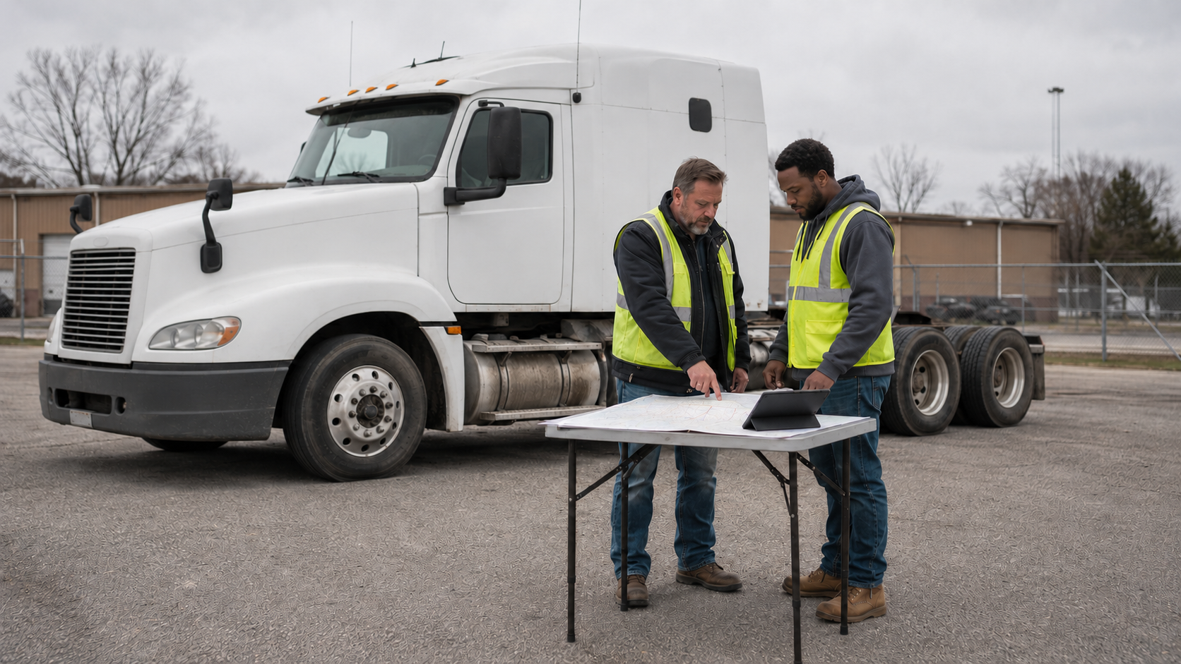
Federal rules do not provide one universal route for every truck. Instead, 49 CFR 392.2 requires a commercial motor vehicle to follow the laws, ordinances and regulations of the jurisdiction where it operates, while a higher applicable FMCSA standard still controls. That makes trip planning an active compliance task: route restrictions can change by State, city, bridge, season, load and permit.
FMCSA’s current driver-safety guidance says to review weather, road conditions, detours and mountainous routes in advance. It also warns that navigation systems designed for passenger vehicles may not identify CMV height, weight or route restrictions. A commercial GPS can improve the plan, but it cannot know every temporary closure, permit condition, construction change or receiving entrance.
Start with the actual vehicle—not a generic truck profile
A routing tool is only as accurate as the vehicle information entered into it. Before planning, confirm the assigned tractor, trailer and load. Record the operating envelope:
| Item | Why it changes the route | Where to verify |
|---|---|---|
| Overall height | Controls bridge, tunnel, canopy, wire and facility clearance | Actual equipment and carrier records; recheck after equipment or load changes |
| Width and length | Affects restricted roads, turns, lane access and permits | Equipment specifications, load documents and permits |
| Gross and axle weights | Affects bridge, road, seasonal and axle restrictions | Scale results, load plan, registration and permits |
| Cargo type | May add hazmat, tunnel, securement or routing requirements | Shipping papers, placards, dispatch and permit documents |
| Vehicle configuration | Changes turning space, off-tracking and legal route options | Physical inspection of the assigned combination |
Do not copy yesterday’s height or weight into today’s route without verifying the equipment. A different fifth-wheel position, suspension setting, trailer, tire size or loaded configuration can change the actual operating dimensions. If a measurement is uncertain, resolve it before departure.
Build the route in four layers
1. Legal and physical route
First confirm that the complete route can legally and physically accept the vehicle. Review truck-route restrictions, bridge and road weight limits, vertical clearances, overall-length rules, seasonal restrictions, permit routing and cargo-specific limitations. Pay special attention to the last few miles, where local roads and older structures create more frequent conflicts.
A posted clearance is a decision point, not an invitation to estimate. If the available clearance is not unquestionably sufficient for the actual vehicle, stop before committing to the structure and obtain a verified alternative. Never depend on another truck’s appearance or assume a recently resurfaced road matches an old database.
2. Road and operating conditions
Next review conditions that affect how long the route will take and how safely it can be driven: construction, closures, heavy traffic, steep grades, sharp curves, wind exposure, snow or ice, flooding and work zones. Identify safe places to pull off before a difficult segment rather than searching while the situation develops.
Railroad crossings need a separate clearance check. A long or low vehicle can become high-centered even when the overhead route is clear. Review the ProntoCDL railroad-crossing guide for approach, track clearance and emergency-notification steps.
3. Hours, fuel and parking
Map the trip onto the driver’s available hours—not the distance alone. Include the pre-trip inspection, fueling, traffic, loading and unloading, scale stops, breaks and a reasonable delay margin. The hours-of-service basics guide explains the separate driving, duty-window, break and multi-day limits that shape the plan.
Select a primary parking location and at least two realistic alternatives. Check whether the stop fits the vehicle, allows the required rest and leaves a legal route for the next day. A plan that reaches the only parking option with minutes remaining offers no resilience when spaces are full or an entrance is closed.
Fuel planning should include usable range, grade, wind, temperature, idling and the distance between truck-accessible fuel stops. Keep enough reserve to avoid turning a missed exit or closed pump into an emergency, while following the carrier’s fuel policy and weight plan.
4. Last-mile access
The final approach deserves its own review. Confirm the truck entrance, receiving hours, gate instructions, staging area, legal turn direction and whether the property has enough room to maneuver. A street address may lead a passenger-car app to the customer entrance instead of the freight gate.
Use satellite imagery or a planning map only as supporting information. Images may be old, seasonal or captured before construction. Confirm critical details with the receiver, dispatch, permits and current official notices. ProntoCDL’s truck road-navigation map can help identify route resources, but it should be treated as a planning aid rather than an official clearance guarantee.
A route plan must allow legal speed
49 CFR 392.6 prohibits a carrier from scheduling a run in a period that would require the CMV to exceed the speed limits along the route. A delivery appointment does not authorize speeding, skipping a required rest period or using a restricted shortcut.
If the legal plan no longer works, communicate early. Give dispatch a specific update: current location, delay cause, available hours, safe options and a realistic arrival estimate. Early information creates choices; a last-minute message after hours expire usually does not.
Use navigation without letting it drive the decision
Configure a commercial navigation system with the correct vehicle dimensions and restrictions, then compare it with carrier-approved routing and current official information. Before departure:
- Review the full route instead of accepting the first suggested option.
- Write down critical exits, route changes, restricted segments and the receiving entrance.
- Download or carry a backup that still works when service is lost.
- Place the device where it does not obstruct the windshield or require handheld use.
- Make route changes only when safely parked.
FMCSA specifically identifies interaction with navigation devices and reading maps while driving as distractions. The mobile-phone and distracted-driving guide explains how to move setup, reading and route changes out of the driving task.
What to do when the route fails
A detour, low-clearance warning or closed entrance can invalidate a good plan. Use a controlled response:
- Reduce speed smoothly and maintain control.
- Do not enter a restricted road or pass a questionable clearance.
- Reach a legal, safe stopping location before using devices or maps.
- Notify dispatch and explain the exact conflict.
- Verify a truck-suitable alternate with current official information.
- Update the HOS, fuel and parking plan before moving again.
Do not back onto a highway, improvise through a neighborhood or follow a passenger vehicle around a restriction. If stopped near a hazard, follow lawful instructions from enforcement or traffic-control personnel.
Trip planning is part of Class A ELDT
The federal Class A ELDT curriculum specifically requires trip-planning instruction. It covers the safest route, rest stops, heavy traffic, railroad-crossing and ground clearance, permits, vehicle size and weight limits, restricted routes, GPS strengths and weaknesses, and fuel-efficient routing.
That curriculum is a useful study checklist even after licensing. Applicants can review the Class A ELDT course overview and use ProntoCDL practice tests to reinforce the rules and safety concepts that support route decisions.
A repeatable departure checklist
- Confirm the actual tractor, trailer, load, dimensions and weights.
- Verify legal truck routes, clearances, bridge limits and permit instructions.
- Review weather, construction, grades, traffic and current closures.
- Check the last-mile entrance and staging instructions.
- Map the trip against available HOS with a delay margin.
- Choose fuel, scale and parking stops plus alternatives.
- Set navigation and review critical turns before moving.
- Recheck the plan whenever equipment, cargo, conditions or dispatch instructions change.
Practical takeaways
- A passenger-car route is not proof that a truck can use the road.
- The route must match the actual vehicle configuration and loaded dimensions.
- Legal routing, current conditions, HOS, fuel, parking and last-mile access are one connected plan.
- Choose parking alternatives before available hours become tight.
- A carrier schedule cannot require speeding.
- Stop safely and re-verify instead of improvising around a restriction.
- Re-plan after any meaningful change to equipment, load, conditions or destination access.
CDL trip planning FAQ
Can a CDL driver rely only on a navigation app?
No. Navigation is a planning aid, not proof that a route is legal or physically suitable. FMCSA warns that non-commercial apps may omit height, weight and other CMV restrictions. Verify the route against current official and carrier information.
What vehicle measurements should be known before routing?
Know the actual combination’s height, width, overall length, gross weight, axle weights and any special configuration limits. Do not assume that a trailer’s nominal size tells you the complete loaded vehicle height or weight.
How should truck parking fit into an hours-of-service plan?
Choose a primary stop and realistic alternatives before the trip, then estimate arrival using legal driving and on-duty time. Recheck availability and conditions early enough to change plans without rushing or exceeding available hours.
What should a driver do when the planned road is closed?
Slow down, follow authorized traffic control and reach a safe place before changing the route. Do not improvise through residential or restricted streets. Confirm a truck-suitable detour with dispatch and current official sources.
Is there one universal safety buffer for posted bridge clearance?
No single federal rule creates a universal clearance buffer for every structure and vehicle. Know the actual vehicle height, obey posted restrictions, account for route and load changes, and follow carrier, permit and jurisdiction instructions.
Does ELDT include trip planning?
Yes. The federal Class A theory curriculum requires instruction on safe routes, rest stops, traffic, railroad-crossing clearance, permits, size and weight limits, restricted routes, GPS strengths and weaknesses, and fuel-efficient routing.
Prepare before the wheels move
Build the knowledge, route discipline and backup plans that turn a dispatch assignment into a safe trip.
Start free CDL practice